Out of Blue + Kochi University of Technology
Data Visualization Design, App, UX/UI Design, Art installation, Japan
Creative Director / Visiting Researcher at Kochi University of Technology: Midori Yamazaki
Engineer: Midori Yamazaki, Gaku Hamajima
Composer: Junpei Asai
• Design Patent Pending in Japan, Design Patent Application No.2025-17470 (意匠登録出願)
• 2025 JpGU Conference Presentation (Japan Geoscience Union / 日本地球惑星科学連合 )
• 2026 JADIS Publication (Japan Society for Disaster Information Studies / 日本災害情報学会)
• NICT Commissioned Research Project No.22605 (国立研究開発法人情報通信研究機構)
• Media Coverage: J-WAVE Innovation World • BS TV TOKYO • Creative Magazine “Brain”
• TV KOCHI & Kochi MIRAI Science Center • Kochi Sun-Sun TV & Kochi MIRAI Science Center
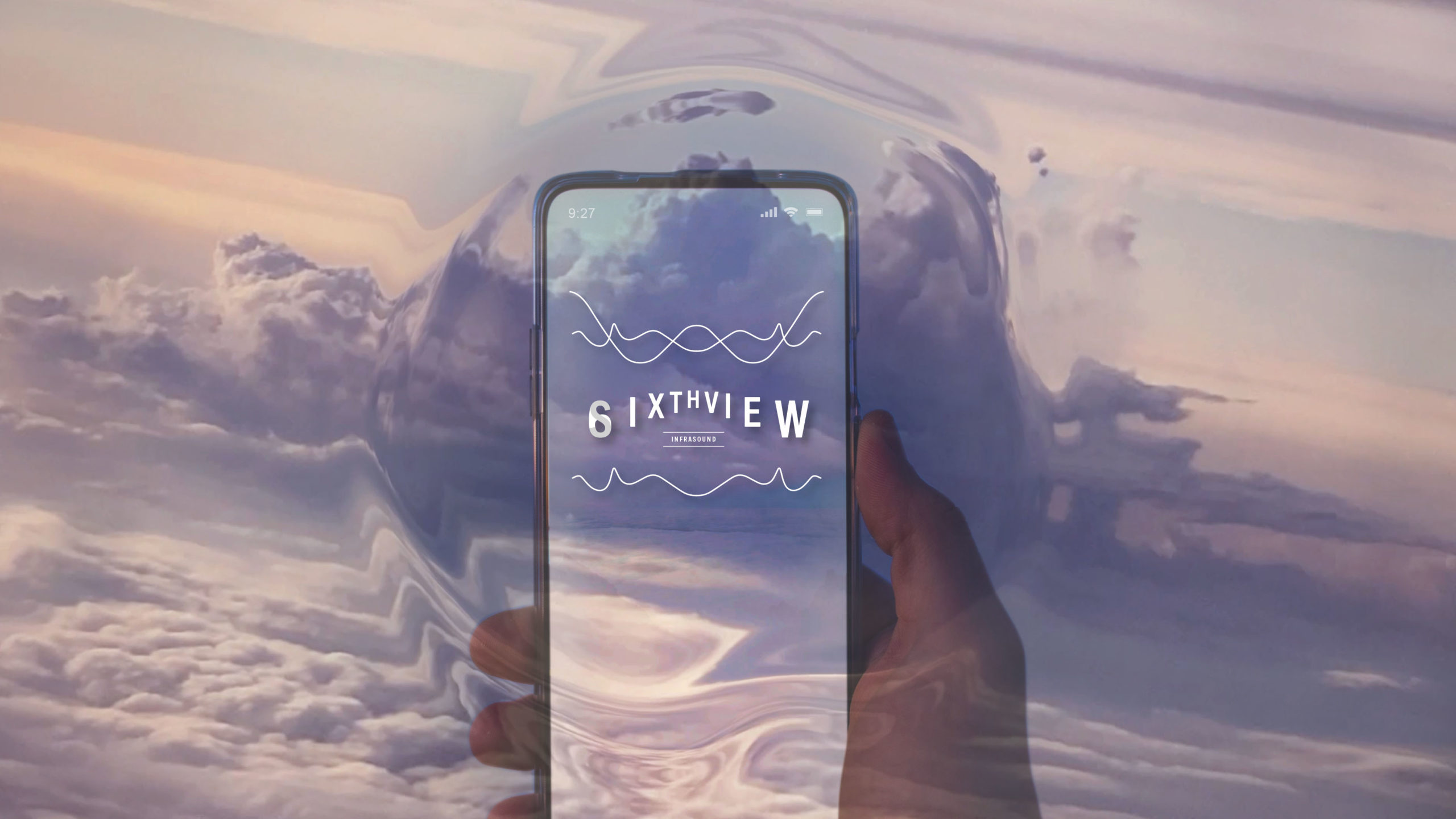
SIXTHVIEW — 感覚を拡張して、地球の声をとらえる
地球の声を聞いて、津波を感知する…。SIXTHVIEWのインスピレーションは、気象情報はデータやメディアからの情報に限られるものではないという、シンプルな気づきから生まれました。人間は、微妙な大気の気配を自然に体感し、察知しています。「第六感」というシンボリックなコンセプトをつかって、この生来の能力を高めるコミュニケーションをデザインすることが、ひいては防災に役立つと考えます。実際に高知県の豊かな自然の中で2年間を過ごし、研究を進める中で得られた気づきや実感が、SIXTHVIEWのデザインに昇華されています。
SIXTHVIEW — Extending Senses, Capturing Voice of Earth
By hearing the voice of the Earth, we can detect tsunamis. Our inspiration arose from a simple realization: weather information is not limited to data or media broadcasts. Humans naturally sense and feel subtle atmospheric cues. By using the symbolic concept of a “sixth sense,” we believe that inventing communication to enhance this innate ability will ultimately improve the quality and accuracy of disaster preparedness. The insights and experiences gained while actually living and conducting research for two years within Kochi Prefecture’s rich natural environment have been sublimated into the design of SIXTHVIEW.

津波災害警戒区域位置図及び区域図
A section of the area along the Kochi coast considered vulnerable to tsunami damage.
Tsunami Disaster Warning Area Map and Area Diagram
地震や津波、火山噴火といった大規模な自然災害によって特に発生する、人間には聞こえないインフラサウンドは、テクノロジーの力で、まるで第六感のように早期に検知することができ、自然事象の理解や、防災に役立ちます。SIXTHVIEWは、学際的なコラボレーションと地域の協力によってリアルタイムIoT観測ネットワークを確立し、これまで専門家だけが扱っていたインフラサウンドをデータを、一般市民にも理解可能に可視化した、リアルタイム自然現象情報GISアプリです。日本は災害が多い国で、巨大地震がいつ発生してもおかしくない状況です。地震や津波などの大規模な自然災害から励起した、人間には聞こえないインフラサウンドを、津波被害が一番大きいと予測されている高知県の高知工科大学とのコラボレーションでセンシングテクノロジーを使って観測し、津波が到達するより早くこのインフラサウンドを早期検知・可視化して一般の人につたえ被害を少なくするなど、より自然事象を観察するツールとして使用することを目的としています。
Infrasound, an inaudible sound generated by large-scale natural disasters, such as tsunamis and volcanic eruptions, can serve as a disaster warning. With technology, it can be detected early, like a sixth sense. Through interdisciplinary collaboration and community support, we created the disaster prevention GIS web app “SIXTHVIEW”. It visualizes real-time infrasound data from an IoT network, making expert information accessible to the public. Japan is a country prone to disasters, and a big earthquake could occur soon. We aim to use sensing technology, in collaboration with Kochi University of Technology—located in a high-risk area for tsunami damage—to observe infrasound generated by large-scale natural disasters such as earthquakes and tsunamis. The goal is for the public to use this tool to observe natural phenomena, visualizing and detecting infrasound data earlier than disasters, such as a tsunami’s arrival, to mitigate damage.
インフラサウンドは低周波音とも呼ばれる、周波数20ヘルツ以下の人の耳に聞こえない音です。インフラサウンドは地球から生み出されていて、例えば、岩盤のずれで生じた海底の隆起や沈下が海水を動かして津波となり、その時、津波は大気を振動させインフラサウンドが生まれます。それを初期段階で観測すると、津波だけでなく、地震、火山噴火、雪崩などの大規模な気象変化の早期検知が可能となります。大気中を伝搬するインフラサウンドを、IoT気圧センサーで、協力者の公共Wifiや自宅回線等を活用し低コスト・多地点で取得。その観測データを可視化デザインし、GIS上に表示して、リアルタイムの自然事象の変化を視覚的に認識できるようにしています。
Infrasound, also known as low-frequency sound, consists of sounds below 20 Hertz, which are inaudible to the human ear. Infrasound is naturally generated by the Earth. For example, when seabed uplift or subsidence caused by rock displacement moves seawater, creating a tsunami, the tsunami simultaneously vibrates the atmosphere, generating infrasound. Observing this phenomenon in its early stages allows for the early detection of not only tsunamis, but also large-scale natural changes such as earthquakes, volcanic eruptions, and avalanches. We acquire infrasound propagating through the atmosphere using IoT barometric pressure sensors deployed at low cost and across multiple locations, leveraging the public Wi-Fi or home internet connections of our collaborators. The acquired observation data is then transformed through visualization design and displayed on a GIS (Geographic Information System), enabling users to visually recognize real-time changes in natural phenomena.

Data on 20 minutes of routine atmospheric pressure fluctuations, containing recorded 2-3 Hz infrasound signals generated by seismic ground vibrations.

The mechanism by which infrasound is generated by tsunamis. Infrasound measurement can be used to observe not only tsunamis but also various other natural phenomena.
見えない、聞こえない、存在を感じることができないインフラサウンドを可視化して、自然現象を認識できるようにすること。また、テクノロジー主導の傲慢なプロダクトにならないよう、インフラサウンドデータのニーズの有無や、求められている使用機会をデザインとして昇華させることはチャレンジングな試みでした。デザインシンキングのプロセスを通じて、一般市民にインフラサウンドデータのニーズ調査を行い、調査から自然事象のインフラサウンド計測情報に一般ニーズがあり、屋外活動時にスマホでの使用がより求められていることや、近年の異常気象に対する不安の意見が多く、観測デバイスの設置に関する興味関心が高いという意見が多いことがわかりました。それらの結果から、求められるユーザー体験(UX)や、非専門家にもわかりやすい可視化デザイン、そして色覚に配慮したユニバーサルデザインを融合した、人間中心の設計(ヒューマンセントリックデザイン)を実現。地域住民が主体的に自然事象情報にアクセスし自ら安全を守るツールを提供して、地域コミュニティで防災の学びを深めながら、市民参加型防災ネットワークの構築を促進し、地域社会全体のレジリエンスを高めることに貢献しています。
Our most significant challenge was making infrasound—something invisible, inaudible, and imperceptible—understandable to the public. Furthermore, it was a challenging undertaking to avoid creating a technology-driven, arrogant product, requiring us to distill the actual needs and desired use cases for infrasound data into an elevated design. Through the Design Thinking process, we conducted a needs assessment on infrasound data among the general public. The survey revealed a public need for infrasound measurement data of natural phenomena, with a high demand for smartphone use during outdoor activities, numerous concerns about recent extreme weather events, and significant interest in the installation of observation devices. Based on these results, we realized a Human-Centric Design that integrates the required User Experience (UX), visualization designs that are easy for non-experts to understand, and Universal Design that is mindful of color vision deficiency (CVD). This approach provides a tool enabling local residents to proactively access natural event information to protect themselves, promotes the establishment of a citizen-participatory disaster prevention network while deepening disaster prevention learning within the local community, and contributes to enhancing overall community resilience.

A community-driven disaster prevention network powered by locally established observation points. We have built an IoT observation system that uses low-latency, asynchronous, bidirectional data communication to acquire measurement information from various locations via a server, and the data is then visualized and displayed on a GIS. In the demonstration experiment, device accuracy evaluation is also a crucial element.

Installation of numerous observation devices with the cooperation of public facilities such as community centers. (Demonstration experiment locations: Kochi Prefecture, Fukuoka Prefecture, Hokkaido, and Ibaraki Prefecture.)

We are promoting the construction of a citizen-participatory disaster prevention network by enabling local residents to proactively access natural event information and deepen their disaster prevention knowledge within their community.
自然事象の変化を可視化デザインする
開発した自然事象情報GIS(地理情報システム)ウェブアプリケーションは、自然現象から発生するインフラサウンドを可視化することで、人々が自然の変化により意識を向けるきっかけを提供します。このGISウェブアプリでは、大気の乱れ(振動)が移動している様子を、視覚的な自然事象情報として観測することができます。つまり、リアルタイムで一般の人にも自然事象情報が認識でき、さらに観測データの取得条件の調整次第で、津波など、災害規模の自然事象の変化もとらえることが可能となり、いままでは専門家の解析のみに頼っていた情報が、機能する可視化デザインによって、わたしたち非専門家にも理解が可能になったことが大きな前進といえるでしょう。これにより、プロダクトの機能による効果に加えて、人間が本来持つ自然を察知する「感覚」が磨かれ、結果として防災・減災意識のさらなる向上につながると考えます。
Designing data visualizations for changes in natural phenomena.
This GIS web application visualizes infrasound generated by natural phenomena, offering people an opportunity to pay closer attention to changes in nature. This system enables users to observe the movement of atmospheric disturbances (vibrations) as visual information about natural events. Essentially, this allows the public to recognize natural event information in real-time. Moreover, by adjusting the observation data acquisition conditions, the application can capture changes in natural events of disaster magnitude, such as tsunamis. A major breakthrough is that information previously dependent solely on expert analysis can now be understood by non-specialists through functional visualization design. We believe that this not only provides the functional benefits of the product but also sharpens the innate human ability to ‘sense’ nature, ultimately leading to a further enhancement of disaster prevention and mitigation awareness.

By designing visualization rules for display on a GIS, real-time measurement data can be visually recognized as natural phenomena information. (Actual screen may vary.)

Design Thinking Process Diagram. Applying design thinking, we designed a human-centric UX/UI based on the analysis of local residents’ usage patterns of natural event information and their interest in infrasound, obtained from an awareness survey. The resulting paper was published in the journal of the Japan Society for Disaster Information Studies.

Real-time visualization and display of the degree of change in natural phenomena (such as atmospheric turbulence), utilizing a universal design accommodating color vision deficiencies. Adjusting the UX/UI design based on smartphone usage needs during outdoor activities, derived from an awareness survey. (Actual screen may vary.)
自然事象の変化を可視化デザイン
リアルタイムで自然事象の変化の度合い(大気の揺れ)を可視化表示する色覚特性に配慮したユニバーサルデザイン。自然事象の変化の度合いを、図形と色を用いて強調するように可視化デザインしており、自然事象による変化が大きいと円が大きく暖色になり、変化が小さいと円が小さく寒色になります。計測データは、通信の遅延が少ない非同期双方向データ通信を使用して、サーバーに集積させている各地点の計測情報を取得するシステムの構築を行い、データを取得しGIS上に周波音の振幅を抽出しています。
Visualization Design of Natural Phenomena Change
This is a Universal Design considering color vision characteristics, which visually displays the degree of change in natural phenomena (atmospheric vibrations) in real time. The visualization design emphasizes the degree of change in the natural phenomena using both shapes and colors: When the change due to a natural phenomenon is large, the circle is larger and rendered in a warm color. When the change is small, the circle is smaller and rendered in a cool color. Regarding the measurement data, a system has been built to acquire measurement information from various locations, which is aggregated on the server using asynchronous two-way data communication with minimal communication delay. The system acquires this data and extracts the amplitude of the infrasound to display on the GIS.

自然事象の変化が小さい時
高気圧が発達していて、大気圧の変化が小さい時など自然事象の変化が小さいとき。紫や青の小さい円が多いのがわかります。実際の天気では、雲が少なく晴天であることが多いなど、一定の傾向があります。
When natural phenomena show minimal change
When natural phenomena show minimal change, such as when high pressure develops and atmospheric pressure variation is low, the visualization displays numerous small purple and blue circles. This pattern exhibits a consistent trend, often correlating with clear, cloudless weather in the actual environment.
自然事象の変化が大きい時
低気圧が発達していて、大気圧の変化が大きい時など自然事象の変化が大きいとき。大きな円が重なり合っているのがわかります。実際の天気では、雲が多く曇りや雨であることが多いなど、一定の傾向があります。
When natural phenomena show large changes
When there are large changes in natural phenomena, such as when a low-pressure system is well-developed and atmospheric pressure changes are significant. Large circles are observed overlapping.
In actual weather, there is a consistent tendency, such as conditions often being cloudy or rainy with many clouds.

Examples of weather when there are minor changes in natural phenomena (e.g., when a high-pressure system is well-developed and atmospheric pressure changes are small). There is a consistent tendency, such as clear skies with few clouds.

Examples of weather when there are significant changes in natural phenomena (e.g., when a low-pressure system is developing and atmospheric pressure changes are large). There is a consistent tendency, such as being mostly cloudy or rainy.
大気圧の変化である擾乱が移動している様子
円が緑色になり大きくなる部分が、左から右へ移動しているのがわかるでしょうか。つまり西から伝わってきた大気の振動が東へ移動しています。この日は寒冷前線が西から東へ通り過ぎており、大気の乱れが発生しやすい状態でした。そして、これは大気の乱れですが、パラメータの調節次第で、津波由来のインフラサウンドなど、災害規模の自然事象の変化も視覚情報としてとらえることが可能になりました。つまり、いままでは専門家の解析のみに頼っていた情報が、機能するデザインによってわたしたち非専門家にも理解が可能になったといえます。
The movement of atmospheric disturbances, which are changes in atmospheric pressure
Can you see the green, enlarging circles moving from left to right? This indicates that atmospheric vibrations originating in the west are traveling eastward. On this particular day, a cold front was passing from west to east, creating conditions prone to atmospheric disturbances. While this example shows an atmospheric disturbance, by adjusting the observation parameters, the system can capture visual information about disaster-scale natural events, such as tsunami-induced infrasound. In essence, information that previously relied solely on expert analysis can now be understood by non-experts through functional design.
地球の研究が人の感覚を拡張する ー もっと「音」をとらえる未来へ
わたしたちは「音」の観測は、災害以外の分野でも活用できると考えています。もしインフラサウンドのセンサーが普及すれば、災害の検知だけでなく、天気の変化や低気圧による体調不良を予測するなど、自然の変化を感じ取る人間本来の機能をサポートするデバイスとしても活用できることができるでしょう。そんな「音」を捉えることが一般的になった未来を想像しながら、わたしたちは日々研究に取り組んでいます。
Expanding Human Senses Through Geophysical Research — Towards a Future That Captures More “Sound”
We believe that observing “sound” can be utilized in fields beyond disaster management. If infrasound sensors become widespread, they could be used not only for disaster detection but also as devices to support the inherent human ability to sense natural changes, such as predicting weather shifts or health issues caused by low pressure. We dedicate ourselves to research every day while imagining a future where capturing such “sound” becomes commonplace.

Exhibition of media art utilizing the atmospheric sensor used in the infrasound observation device. The device size is 32 millimeters.

At the Kochi Mirai Science Museum, we demonstrated the mechanism for early tsunami detection using infrasound. We also explored the potential for a citizen-led disaster prevention network through a dynamic talk event, exchanging information with local residents and experts who conduct disaster research in Kochi Prefecture, including collecting testimonies from past Nankai Earthquake victims and performing field research.

Our app and its mechanism for early detection of natural phenomena, such as tsunamis, have been widely featured in the media. This attention came because our infrasound visualization design succeeded in making the information understandable to the general public. (Pictured: Kochi Sun-Sun TV *Currently a visiting researcher at Kochi University of Technology)

As disaster awareness outreach, we shared the observation technology and prevention knowledge through exhibitions and lectures ( Fukuoka City Science Museum, Sapporo Science Center).

Experiencing future disaster prevention technology by playing with media art that utilizes the sensor used in the infrasound observation device.
*1. 本実証実験は、国立研究開発法人情報通信研究機構委託研究22605(研究開発課題名:データ利活用等のデジタル化の推進による社会課題・地域課題解決のための実証型研究開発、副題: 地域防災のための多地点微小気圧変動計測パッケージの標準化と都市近郊・中山間部における市民協力型実証実験、研究代表者:高知工科大学、 研究分担者:産業技術総合研究所、九州大学、北海道情報大学 )により行われています。また福岡市の実証実験フルサポート事業に採択、同市内公民館等の協力のもと実施・北海道情報大学 健康情報科学研究センターの管理部門をはじめ臨床試験部、情報管理部には質問調査の協力をいただきました。アンケートに回答くださった皆様を含め、ご支援いただいたすべての方に感謝します。
*2. 全国インフラサウンド観測コンソーシアム <協力機関>◼︎とりまとめ機関:高知工科大学 総合研究所 インフラサウンド研究室 / 一般財団法人 日本気象協会 防災事業部 ◼︎研究協力機関・団体:株式会社クローネ / 京都産業大学 / 国立研究開発法人情報通信研究機構(NICT)レジリエントICT 研究センター / 北海道情報大学 情報メディア学部 情報メディア学科 (アイウエオ順)
© 2025 Out of Blue / Midori Yamazaki : 意匠登録出願済 意願2025-17470 このプログラムにおけるデータを可視化したビジュアル表現は、山﨑みどりがリサーチに基づきデザインしたオリジナルな表現で著作権を持っています。侵害された場合は侵害行為の差止めや差止めに付随する廃棄、侵害行為による損害賠償などを請求する場合があります。 また、研究代表者:高知工科大学、研究分担者:産業技術総合研究所・九州大学・北海道情報大学・電子開発学園、連携研究者:京都産業大学・日本気象協会・大阪大学、から侵害された場合においても同様です。
*1. This project was carried out as part of NICT commissioned research project 22605, “Evidence-based research and development to resolve social and regional issues through the promotion of digitalization, including data utilization; subtitle: Standardization of a multi-point micro-atmospheric pressure fluctuation measurement package for regional disaster prevention and citizen-collaboration demonstration experiments in suburban and mountainous areas. Lead Institution: Kochi University of Technology, Collaborating Institutions: National Institute of Advanced Industrial Science and Technology (AIST), Kyushu University, Hokkaido Information University” Selected for Fukuoka City’s full support program for demonstration experiments, and implemented in cooperation with community centers and other facilities within the city. In addition, in conducting this research, we received cooperation from the Administration Department, Clinical Trials Department, and Information Management Department of the Health Information Science Research Center at Hokkaido Information University, who provided assistance with the questionnaire survey. We would like to thank everyone who responded to the questionnaire and everyone who provided support.
*2. National Infrasound Observation Consortium <Collaborating Institutions> ◼︎ Coordinating Institutions: Kochi University of Technology, Research Institute, Infrasound Laboratory / General Incorporated Foundation (G.I.F.) Japan Weather Association, Society and Disaster Prevention Business Division ◼︎ Research Collaborators: Krone Co., Ltd. / Kyoto Sangyo University / National Institute of Information and Communications Technology (NICT), Resilient ICT Research Center / Hokkaido Information University, Faculty of Information Media, Department of Information Media (Alphabetical Order).
© 2025 Out of Blue / Midori Yamazaki : Design Patent Pending in Japan, Design Patent Application No. 2025-17470, The visual representations that visualize the data in this program are original expressions designed by Midori Yamazaki based on her research and are copyrighted. In the event of infringement, we may request an injunction against the infringing act, disposal accompanying the injunction, and compensation for damages due to the infringing act. This also applies in the event of infringement by the Lead Institution (Kochi University of Technology) or the Collaborating Institutions (National Institute of Advanced Industrial Science and Technology, Kyushu University, Hokkaido Information University,
Electronics Development Computer College) or the Collaborating Researchers (Kyoto Sangyo University, Japan Weather Association, Osaka University)